Spring Floods in the U.S. Midwest and Canada
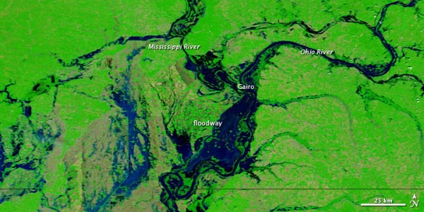
 acquired May 4, 2011
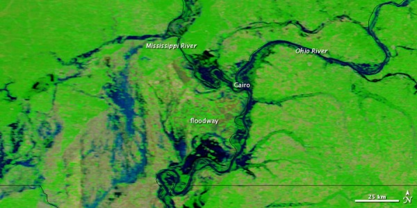
 acquired April 29, 2011
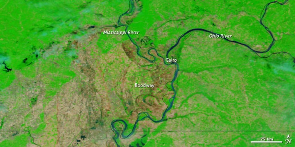
 acquired April 29, 2010
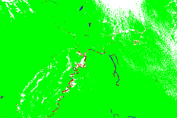
 color-coded flood detection map
After the U.S. Army Corps of Engineers breached a levee to save the city of Cairo, Illinois, on May 2, 2011, agricultural fields remained flooded two days later. The levee breach flooded roughly 130,000 acres of nearby farmland in the Birds Point-New Madrid Floodway.
The Moderate Resolution Imaging Spectroradiometer (MODIS) on NASA’s Terra satellite captured these images of the area on May 4, 2011 (top), April 29, 2011 (middle), and April 29, 2010 (bottom). All three images use a combination of visible and infrared light to increase contrast between water and land. Water ranges in color from electric blue to navy. Vegetation is green. Bare ground is earth-toned.
The most striking difference between May 4 and April 29, 2011, is the inundation of the Birds Point-New Madrid Floodway. Both scenes, however, show severe flood conditions along the Mississippi and Ohio Rivers. The image from 2010 shows the rivers under more normal circumstances.
NASA images courtesy MODIS Rapid Response Team, Goddard Space Flight Center. Caption by Michon Scott.
- Instrument:
- Terra - MODIS